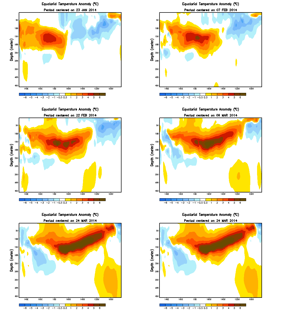
Since a couple of weeks I’m following Robert Scribblers website where he describes the building up of a monster El Niño that is bound to influence global weather this and next year.
The graphs may seam a bit confusing at first, but once you understand what they mean they become self explaining:
This is a cross section of the Pacific at the equator. Left is Malaysia right is South America (Equador). Top to bottom is the depth of the upper 500 meter of the ocean. The normal situation is that hot water sits on the left because trade winds blow from east to west and the warm water gathers on the west side of the Pacific. What happens during an El Niño is that suddenly a gush (a really large gush) of heated water “flows back” to the East (beneath the surface) and pops up at the coast of South America, this pulse of hot water is called a Kelvin Wave. When this happens, the sudden pool of hot water (at least 5 degrees warmer than normal, but now even higher) creates dramatic climate affects globally, the last large El Niño in 1997 (the beginning of the temperature “hiatus” for the denialists) caused global temperatures to surge by 1 degree Celcius, cause droughts, heat waves, floods, bad crops and more. This El Niño is set to be larger than that one:
NB1 : the top picture is of the 1997 El Niño
NB2 : all pictures show anomalies, the difference with what is normal, so the water flowing east is 6-7 degrees warmer than the water there normally is.


Geef een reactie